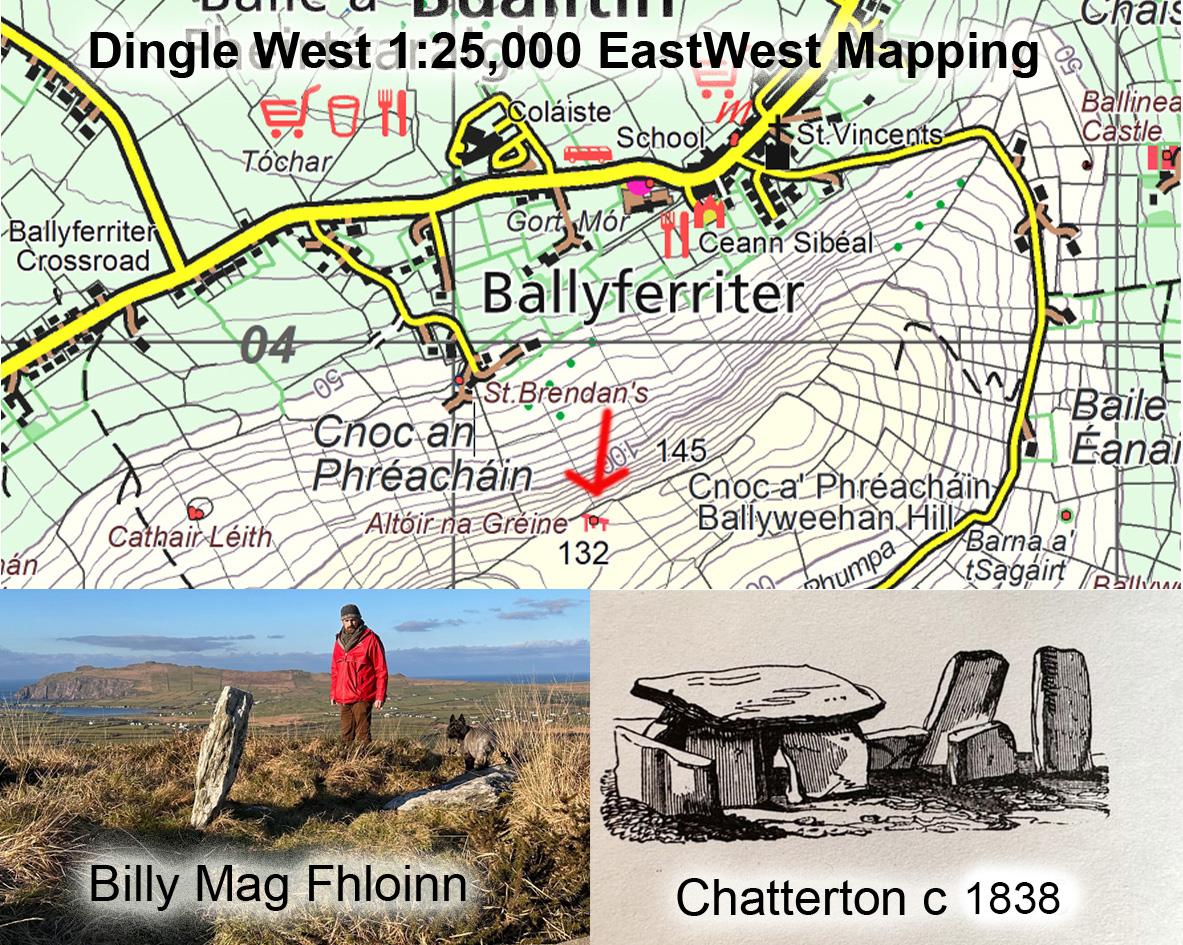
Altóir na Gréine
There was a well publicised news story last week concerning the re discovery of a probable megalithic tomb in Dingle, Co.Kerry. Local man Billy Mag Fhloinn who is involved in archaeological research in the region was checking out old written accounts that gave accounts of a site called Altóir na Gréine near the village of Buailtín or Ballyferriter.
Critically the site was visited, documented and sketched in good condition by a Lady Chatterton around 1838 and recalled in the folklore collection of a century later. An intermediate account suggested that the tomb was broken up and used for building materials. Given the elevation of the site, these were hardly for actual buildings below, perhaps for nearby ditch/ wall construction. It’s known that the clergy of the day sometimes took a dim view of ‘pagan’ sites and perhaps they sanctioned dismantling.
Anyway Billy took to the hill with description and sketch and identified the site as it stands now. This area is covered by our Dingle West 1:25,000 mapping and here is an update with location of what is now a national monument. The placename Altóir would indicate some religious aspect and the word Gréine refers to the sun.
What this story does demonstrate is that our uplands are not just waste places to be exploited for wind farms and forestry etc. Where they have not been developed, they can contain many cultural aspects of our past. Sites like this that would often have been cleared away in areas of more intensive agriculture and urban construction. But also in terms of placenames – old names that record the wet or rocky nature of parts of the hills often still have the same relevance centuries later.
#eastwestmapping #dingle #hillwalkingireland #dingleway