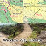
Wicklow Way Update

Wicklow Way Update Map update for Wicklow 1:25,000 print maps & Wicklow Way Map Guides. Thanks to Aaron Byrne of Wicklow Partnership for supplying details of a recent re route…

Continue Reading Wicklow Way Update

Black Mountain Donard

Black Mountain or Sugarloaf near Donard, Wicklow When looking into placenames, it often pays to look at the ground - as placenames often relate to the physical appearance or nature…

Continue Reading Black Mountain Donard

Wicklow Way 1993

Wicklow Way 1993 Pictured here is the first EastWest Mapping publication from 1993, thirty years ago. There was no accurate map of the full Wicklow Way walking route then and…

Continue Reading Wicklow Way 1993

Mountain Training 2023

If you’re starting out or would like to brush up on your hill navigation skills, get advice on equipment and generally learn to manage your hillwalks as safely as possible,…

Continue Reading Mountain Training 2023

Fair Mountain

The Fair is a rounded hill just west of the Turlough Hill ESB pumped storage scheme in Wicklow. The photo here shows two of the large pylons that run down…

Continue Reading Fair Mountain

New Dublin & Wicklow Maps

Three New 1:25,000 scale detailed maps are now available for the Dublin Mountains, Wicklow West and Wicklow East. It may have taken five years with lots of hiccups and hard…

Continue Reading New Dublin & Wicklow Maps