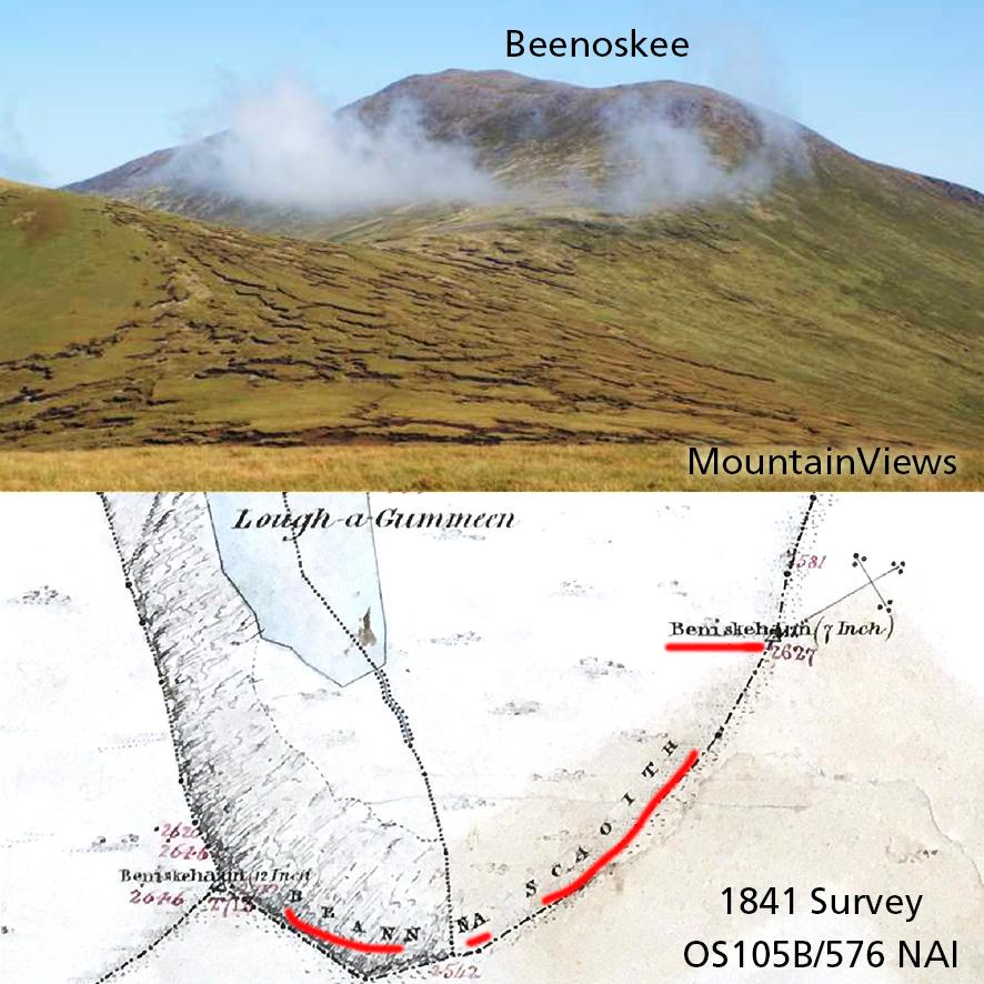
Beenoskee is the highest hill in the central section of the Dingle peninsula and overlooks the Magharees. The name is generally understood now in Irish to be Binn os Gaoith, the peak above the wind or the peak above the flow of Tralee Bay. Neither really makes much sense. Locally I’m told it’s often referred to as Been and the ‘oskee’ bit is a ‘map name’.
Here the field survey records of the 1841 OS survey of the area are interesting. The field surveyors returned two names for this peak: Beann na Scaoith and Beniskehaun. They also recorded a name Binoschee about two and a half kilometres away, on the high ground lying between Glanteenassig and Lough Annascaul.
On the final printed Six Inch maps, the name Beenoskee appears where Binoschee is and also the same name on the mountain summit that the field surveyors labelled Beann na Scaoith and Beniskehaun. I suspect a transcription error or assumption in the Phoenix Park that these were the same names/ places.
Since the name Beenoskee is well known now for the main hill, I’ll leave it as such on our new Dingle mapping. But I wouldn’t have much faith in the accepted Irish version of Binn os Gaoith, since clearly the records point more towards something like Binn na Sciatháin or Binn na Sciath, where sciath perhaps refers to the steep walls of cliffs that guard this height. To further muddy the waters, there are maps predating the OS that have the name Binshehy hereabouts.
#eastwestmapping #irishplacenames