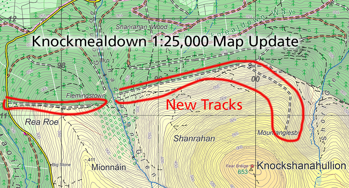
Knockshanahullion Map Update
Thanks to Maureen O’Brien for spotting and plotting details of some prominent new tracks that have been excavated on the northern slopes of Knockshanahullion in the Knockmealdown Hills. These are principally wide firebreak tracks along the plantation edge but one track in particular has been cut into the hillside and rises up the spur to an altitude of c 500 metres.
If you own a copy of our Knockmealdown 1:25,000 scale map, then no harm to update to reflect this.
#eastwestmapping #kmdactive #munstervales