5 Metre Contours
We use a 5 metre contour interval on our 1:25,000 scale maps in order to show the shape of the land in a more detailed way. On the whole, customers find this satisfactory but we do receive the odd comment that there are ‘too many’ contours or that it’s too hard to count the contours etc. That a 10 metre or even 15 metre interval would be preferable.
On the question of contour density, it should be remembered that a 10 metre interval is actually denser on a 1:50,000 scale map. A 5 metre interval doubles the number of actual contours but if you compare a square kilometre box on both maps, you’ll see that the 1:25K map is four times the size of a 1:50K.
For counting contours to estimate height gain or loss, I recommend that you look for the frequent spot heights. Subtracting two spot height readings and then adding or subtracting a few contours is easy with a little practice. And/or look for the contours that are labelled with heights every 50 metres.
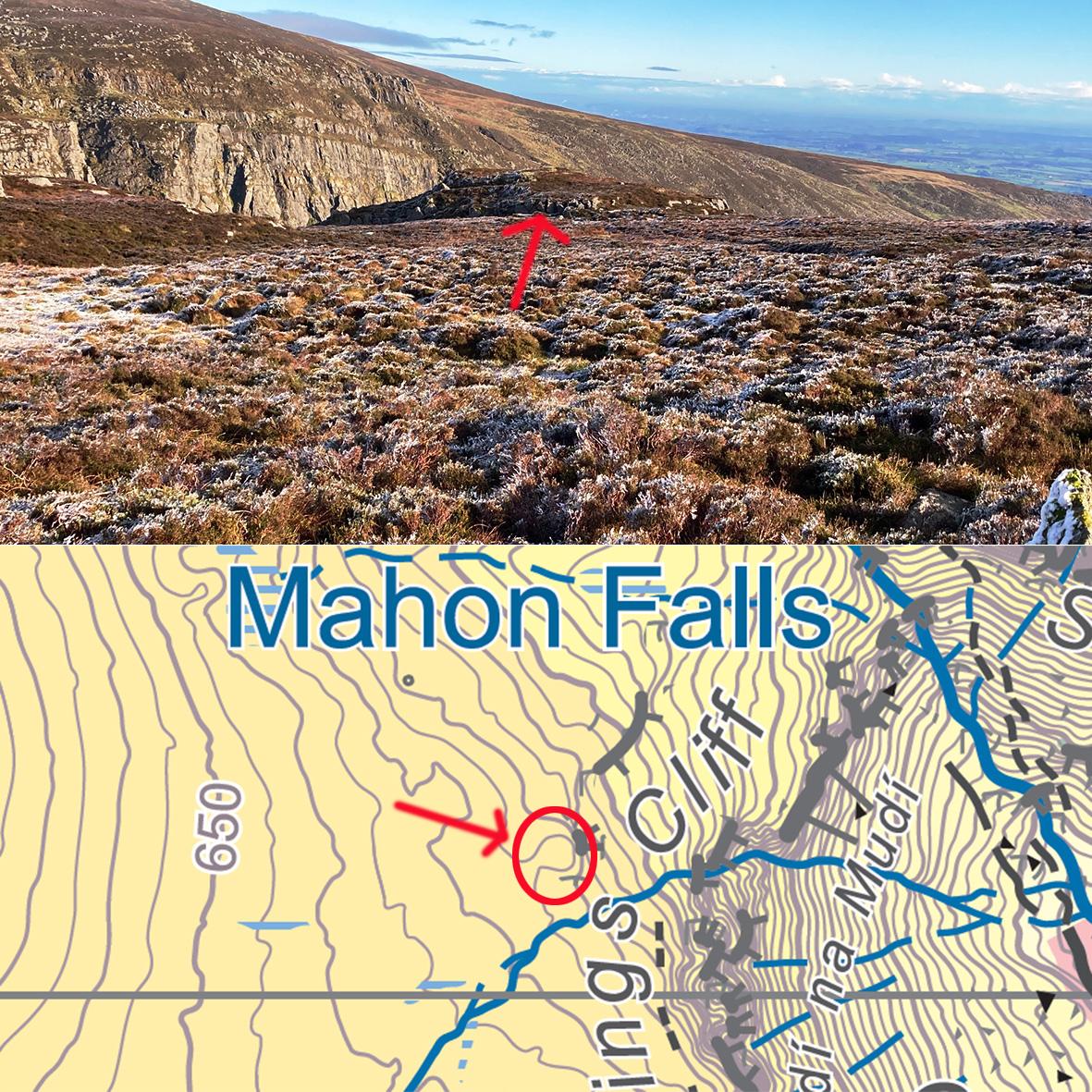
For general hill navigation a 10 metre interval is indeed fine. Our maps are also used for challenge type events & training where smaller features are required to be located. The image here is of a typical hill feature, a knoll which is portrayed with a 5 metre interval but would be lost with a 10m contour spacing.
#eastwestmapping #comeragh #mountainskills