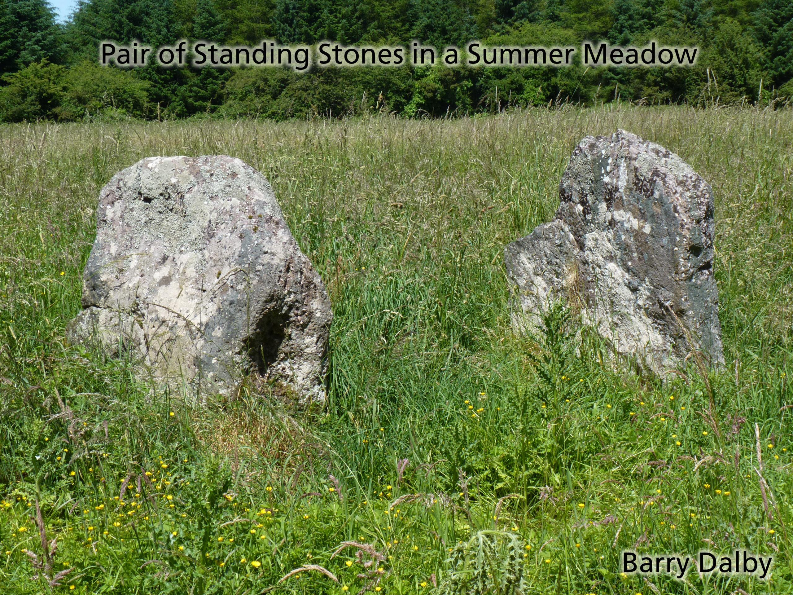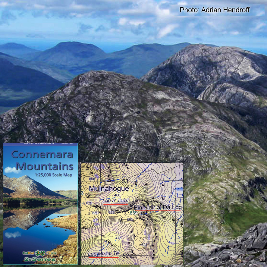
Doo Lough Names
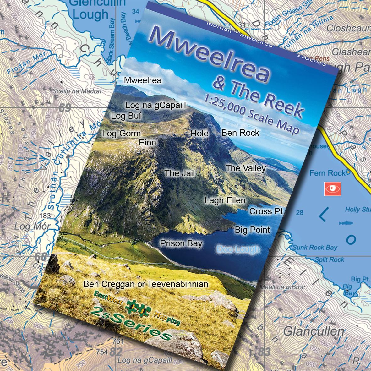
The fine photo on the cover of the new map of Mweelrea & The Reek was taken by John Finn of Cork and captured from the slopes of Ben Creggan or Teevenabinnian as known locally. It looks down on Doo Lough (the dark lake) and across to the Mweelrea/ Muilrea massif. Apart from the capturing the nature of this dramatic landscape, the photo was also used to discuss placenames with men who still gather sheep there. Here are a few of the local names as found on this new map, a mixture of Irish and English names in keeping with the culture and history of the region.
- Einn, said like ‘ion’, rhyming with ‘fine’. Used for this height and slopes below.
- The Jail, difficult ground on Einn where sheep get stuck. Prison Bay lies below.
- Big Point and Cross Point, jutting headlands on Doo Lough.
- Lagh Ellen, said like ‘loch ellen’ – the slopes of ‘ellen’, which may be a version of Chuillinn as in Glencullen above.
- The Valley, deep com well known to hillwalkers and the way up to Leota Mór or The Ramp.
- Ben Rock, notable peak on far side as you rise up the Ramp.
- Hole, a deep pocket on the steep slopes above Lagh Ellen.
- Log Gorm, the (bluish) hollow/ valley to your left as you rise along Einn.
- Log Buí, the (yellowish) large valley beyond Log Gorm. After a bit of rain, a noticeable white stream is seen falling down from Log Buí as you drive up towards Delphi. This is the Sruthán Buí.
- Log na gCapaill, refers to the upper part of Log Buí just below the long level ridge that leads to Binn Buí and Ben Lugmore. The ‘capall’ or horse reference here is I think to the level ridge, like looking up at a horse back.
#eastwestmapping #mweelrea #connemara #visitmayo #mountainviews.ie #mayohillwalkers