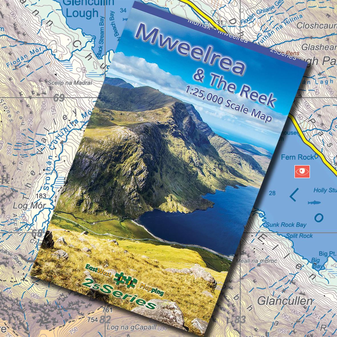
New Map ~ Mweelrea & The Reek
A new detailed map for the Mweelrea region of Co.Mayo is now available. It covers from Killary Harbour northwards to The Reek / Croagh Patrick on the shores of Clew Bay. Overlaps with our popular Connemara Mountains map to provide continuous coverage.
Produced to our 25Series standard, the map is printed at 1:25000 scale with a 5 metre contour interval. There has been considerable research into the placenames of the district with more of a return to pre Covid practice of visiting local landowners.
This new map is available in various forms 1) standard printed folded 2) laminated waterproof folded and 3) flat unfolded for wall display. It can be purchased either singly or with a discount as part of a set. View purchase options: Buy Mweelrea Map.
A map like this takes c.8 months to prepare plus costs and we rely on print map sales in particular to recover costs – that’s a lot of maps to sell! So you can help both by purchasing a copy and also by spreading the word that it is available. Thanks for your support.
#eastwestmapping #mweelrea #connemara #visitmayo #mountainviews.ie #mayohillwalkers