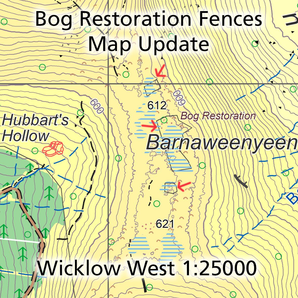
Bog Restoration Map Update
Thanks to Hugh McLindon of NPWS for sending on details of three fenced off areas on the ridge from Mullaghcleevaun to Tonelagee in Co.Wicklow. Many hillwalkers will know this as a tough place in wet weather particularly with numerous peat hags and soft ground.
The mountain blanket bog has been eroded over many decades and this project is now seeking to test a few areas to see if the bog can regenerate itself with assistance.
The three fenced areas are marked here and the area is covered on our Wicklow West 1:25,000 so update this map. Apart from being notable for navigation purposes, the fenced areas should not be entered into or disturbed in any way. Locally this gap would be known as Barnaweenyeen.
#eastwestmapping #wicklowmountains #wicklowmountainsnationalpark