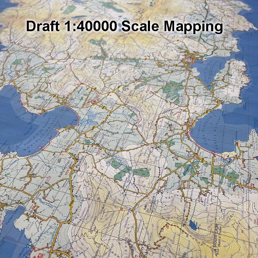
This is some draft detail from 1:40000 scale mapping of the Dingle peninsula. Where 1 kilometre on the ground = 2.5 centimetres on the map, with a good 10 metre contour interval and with prominent upland features marked liked major cliffs and significant fences. Whilst plotting topographic detail to our 25Series standard, I created separate layers for features that would only be specific to 1:40K mapping, so layers for selected cliffs, paths and boundaries etc. This made it quick & convenient to reduce the scale and drop the layers that contain the more detailed features, though the text labels required selection and editing. Technically I’m pleased with the 1:40K result, it’s clear but detailed for that scale and quite superior to the published 1:50K mapping.
However it’s one thing having an idea and another to see it implemented. The problem is figuring out who exactly the map is designed for and who might buy it. The more detailed 1:25000 maps will meet the needs of those exploring the hills & coast. Since there are some compromises in these in terms of coverage, I thought the 1:40K might suit as a more general tourist map. But there are two problems with this a) it’s more detailed than the average tourist requires and more importantly b) tourists don’t really buy maps anymore! They/ we when visiting on holidays mostly use Google Maps, Apple Maps or maybe OpenStreetMap on a phone app. If they go into a Fáilte Ireland tourist office, they won’t be able to buy a map but can avail of EU funded free leaflets and maps.
So I’ve shelved the idea for a while, maybe it’ll resurface sometime in the future! Happy Christmas to all our customers and followers and wishing you all the best for 2023.
#eastwestmapping #irishmaps #cartography