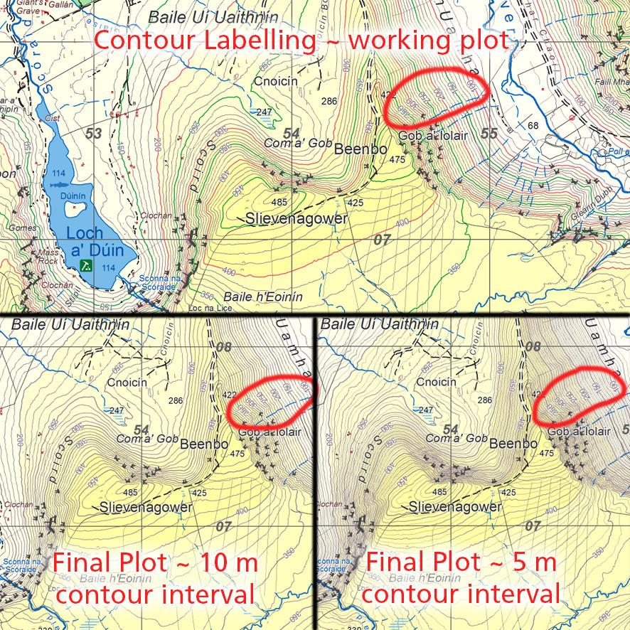
All text on a topographic map potentially obscures useful detail underneath, whilst adding usefulness. Placename text is positioned first, then Grid Labels, followed by Spot Heights and finally Contour Labels are added. We add numbers to the contour lines at 50 metre intervals with occasional 10 metre labels at lower levels. These are useful to the map reader to facilitate estimating height at any given point – find the nearest contour label and count contours up or down to spot desired.
There exists software that will automatically generate contour labels but map making is a craft and in reality, each label must be added individually & manually so as to avoid other text and useful detail. This human interpretation is essential but also very repetitive whilst requiring a deal of concentration. It’s a task that you put off starting and are glad to have finished!
A couple of useful tactics are first to temporarily change the colours of 50m & 100m contours so you can more easily keep track. Then secondly in an upland area, to work downwards and outwards from the summits. After that two further factors come into play, the labels should be placed at or near but not obscuring spurs and ridges as these are where most people will travel. Then also that they are repeated sufficiently often so that contour labels can readily be found on a folded down map i.e. as in use on the hill.
Manually placing a set of such labels for a typical 1:25K map can easily take 2-3 full days, down & up, backwards & forwards. Rinse & repeat.
#eastwestmapping #irishmaps #cartography