Ordnance Survey This Century
Part four of a short series on Irish Mapping: past, present & future.
The Ordnance Survey in Ireland was set up on the foot of the Spring Rice report in 1824, run by the British military through the 19thC and following independence in the 20thC by the Irish Defence Forces but also answering to and funded by the Dept of Finance.
With changing technology, civilian recruitment and a requirement to be more commercial, a new semi state body Ordnance Survey Ireland or OSi was set up in 2002. Accounts of the latter years show a c€30M turnover with most of this deriving directly from an Oireachtas grant plus licencing fees from local authorities and other state and semi state bodies like ESB, National Roads Authority etc. A small amount of income came from true commercial sales and even less from tourism/ recreation maps like the Discovery Series and road maps.
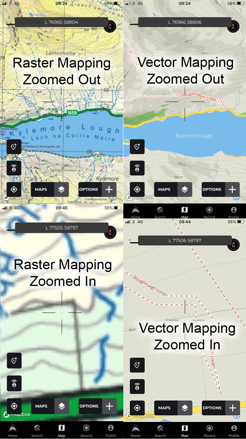
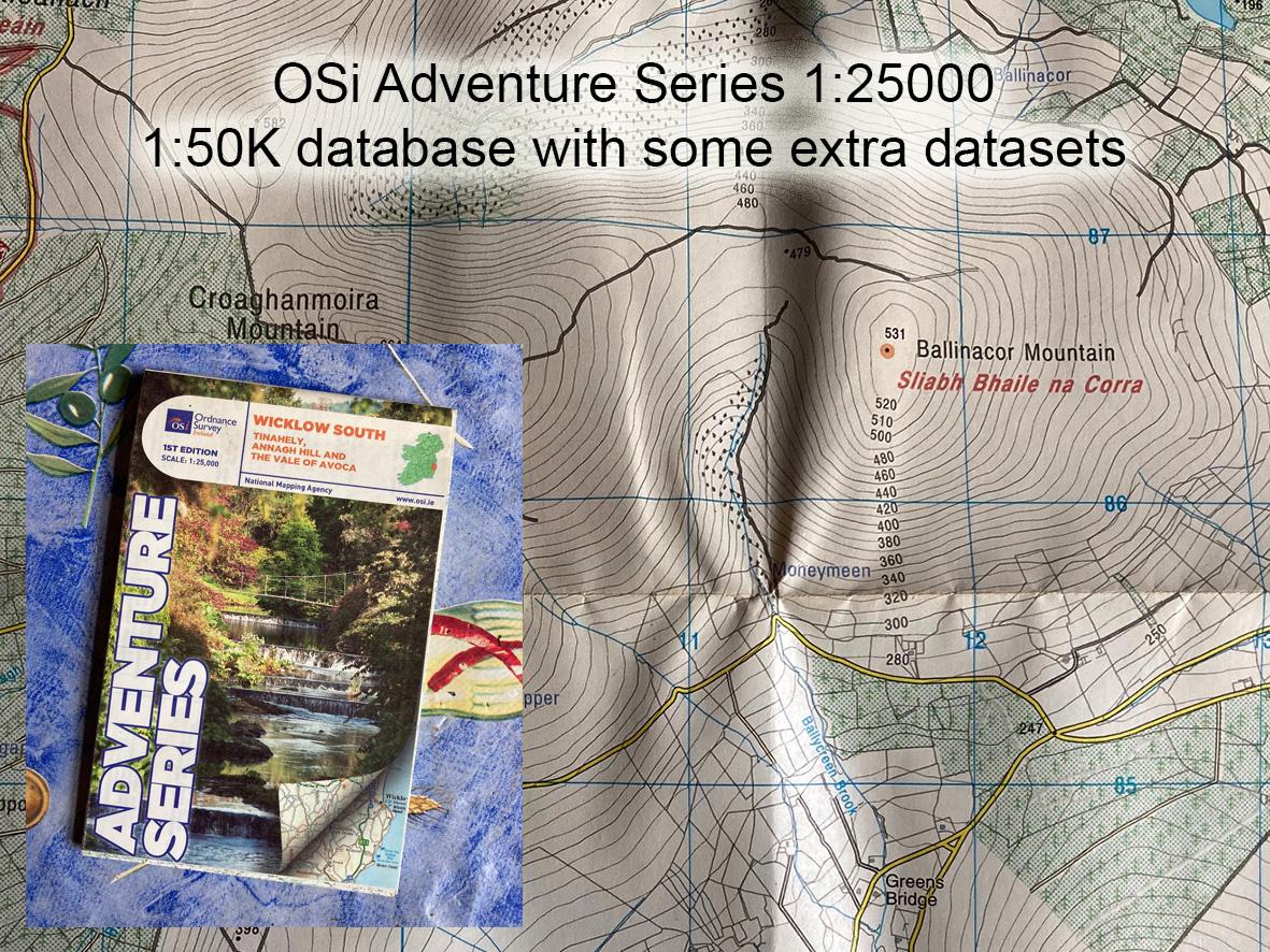
As regards small & medium scale mapping, the only notable development in the first twenty odd years has been the publication of a few 1:25,000 sheets styled as the Adventure Series. These latter are essentially an enlargement of the Discovery Series 1:50K data, with a few extra data sets thrown in. They are derivatives of existing data, office solutions with little evidence of fieldwork and not true 1:25K maps.
Last year in 2023, Ordnance Survey Ireland or OSi was dissolved and incorporated into a new public body called Tailte Éireann along with the Property Registration Authority and the Valuation Office. This new body is now entirely publicly funded and under the Dept of Housing, Local Government & Heritage. Essentially this is a return to the 19thC roots & culture where the Ordnance Survey and the Valuation Office worked closely together as part of Griffiths townland and tenement valuations.
This all makes sense as far as the true focus of the national mapping agency in Ireland goes – that of land registration, valuation, taxation plus the large scale mapping needs for planning for projects both at local & national level. Why is this relevant you may ask? Well where does that leave small & medium scale mapping, as used by the public to explore the countryside??
#eastwestmapping #cartography #irishmaps #mountainviews #mountaineeringireland