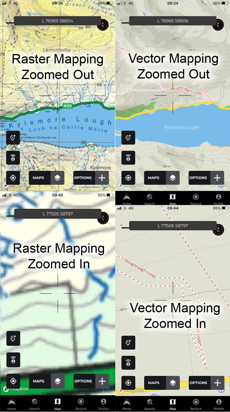
Map File Formats
There are two principle types of file format associated with publishing maps: vector and raster or bitmap. Think of the various map apps on your phone. Examples of vector maps would be Google Maps or OpenStreetMap, with such mapping you’ll notice that the level of detail increases as you zoom in and there is no loss of sharpness. This is good, however the overall appearance is more ‘bare bones’ style. The mapping doesn’t look like a conventional print map and the publisher has less control over how it appears on your screen.
Examples of raster or bitmap maps on your device would be our EastWest Mapping maps on the Hiiker app or ditto for OSi or Harvey maps etc. Essentially what you have here is a screen copy of the print map which is rendered like a photograph, where the detail is defined in dots of colour. Like a photo, when you zoom in, the detail gets more pixellated and fuzzier. Meanwhile when zoomed out, the detail is not simplified. The advantage is that this raster mapping looks like the equivalent print map and the publisher has full control over how it appears on your screen.
However regardless of how mapping is published, all modern mapping is compiled in a vector format. The basic map structure is made up of points, lines, areas and text. Examples of each would be a building, a road, a forest and of course placenames. The locations are stored as co-ordinates for a point or a series of co-ords for a line or area. A symbol which has been designed for the feature is then applied. This is held in a database and the vector map detail can be readily manipulated and edited. A map will contain thousands of such records and a feature like a path or a building can be added or deleted with a click of the mouse. If a map were compiled in raster format, this would be far harder to do neatly, like editing a photograph. And we all know from recent events how hard it can be to get that right!
#eastwestmapping #hiiker #cartography #irishmaps #mountainviews #mountaineeringireland