AI & Mapping
Part nine of a series on Irish Mapping: past, present & future.
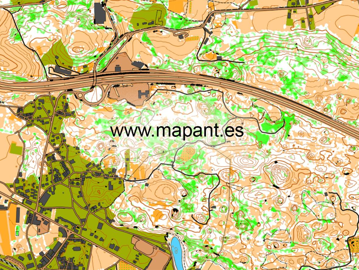
Back in 2020, I wrote a blog piece on ‘auto mapping’ in New Zealand. Similar projects progressed during Covid times and the image here is a small extract from a similar map of the entire territory of Spain. Look up www.mapant.es to view this map in all it’s glory.
Of course, the term AI has become current since, the machine processing of data to produce something that formerly only humans could create. This AI map of Spain is a collaboration between Orienteering Spain (FEDO) and the Spanish Mapping Agency (IGN) and also combines with data from OpenStreetMap. The key to generating the contour, cliff and vegetation detail is the use of LiDAR data, which is detailed topo information collected by a LiDAR sensor mounted in a survey plane. This vector data was then combined with datasets for roads and settlements from IGN and OSM and has resulted in this very impressive result. This is an orienteering map but there is no reason why similar techniques could not be used to prepare more general mapping. With the obvious caveat that such AI cannot record cultural / heritage sites or placenames.
Three basic things are needed to generate AI mapping: LiDAR coverage, substantial processing power and storage of all the data plus of course the relevant AI software. Will it happen in Ireland? LiDAR data is currently patchy in coverage, is expensive to fly and even if the state does fund full coverage at some stage, there’s no guarantee it’d be open source to the public as in Spain or Finland etc. Though the trend in public agencies in EU states now is to provide publicly funded data to the public.
The AI software (Karttapullautin) used in this Spanish map was developed for hobby and non commercial use. However I’ve little doubt but that there are commercial & state agencies developing their own solutions as you read this.
#eastwestmapping #irishmaps #mountainviews #mountaineeringireland