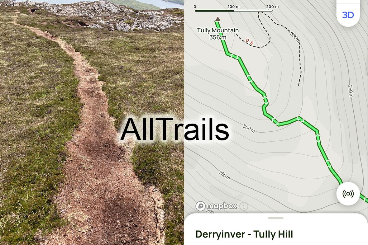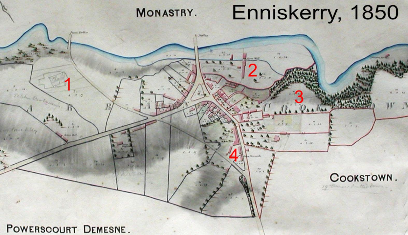
The townland in rural Ireland is a core part of identity, it’s a form of local address and place. Townland, parish & county to some extent define people. There’s a tendency to think that townlands are very ancient and doubtless some are. However our modern understanding of townland names and boundaries was fixed in the 1830s by Richard Griffiths boundary survey. This was a huge undertaking that fixed the names and boundaries of over 60,000 townlands on the island.
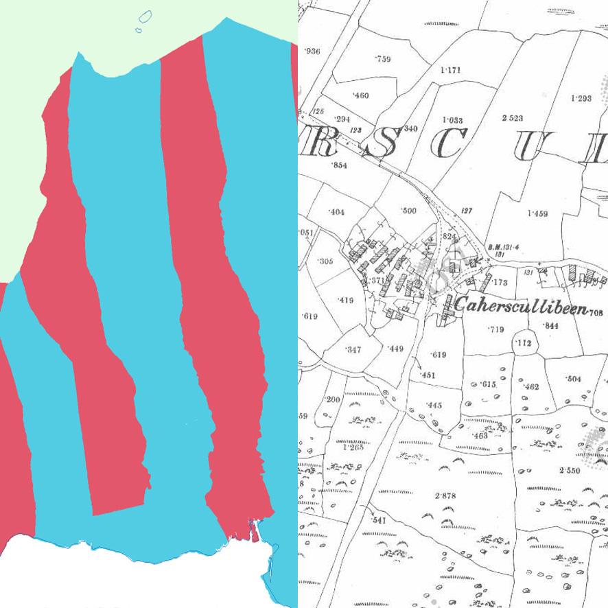
To a large extent this was imposed onto a much broader and flexible concept of the townland. The townland was really a place where people lived rather than a unit of land measure. The typical settlement pattern in many upland and coastal areas was a cluster of houses, numerous ‘villages’ like Caherscullibeen shown here. This tight knit area was the ‘townland’ with crops grown in summer, with cattle sent to graze on nearby uplands and herds returning to low ground after the harvest. So Caherscullibeen was a ‘townland’ with it’s extended mountain grazing. Such upland grazing would have overlapped with neighbouring villages and boundaries must have been fluid – more like a big commonage with certain parts associated with certain villages.
Into this way of living came the boundary surveyors, who were charged with deciding official names and boundaries for what has become set in stone since. In some cases they must have found reasonably well agreed boundaries, particularly in the low and better lands around settlements and estates. But there is no doubt that many of the townland boundaries on uplands and marginal lands were just made up. The image here also shows a set of a few townlands running from the sea to the mountain crest. Essentially they are just a series of parallel strips and were contrived to make some division of the common areas.
#eastwestmapping