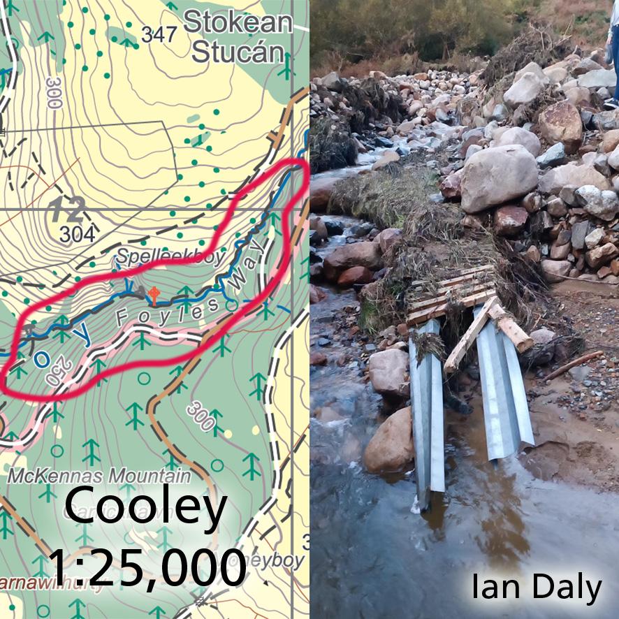
Cooley Map Update ~ Foyles Way
The Cooley region of Louth was badly affected by heavy rain and floods at the end of October, damaging several roads and flooding property etc. It’s also reported to me by map user Ian Daly that the riverside path called Foyles Way with it’s 20+ footbridges has sadly been mostly washed away.
This was largely a labour of love for local man Joe Foyle in recent years who carried in and assembled all these bridges by hand. You’ll find the path and bridges marked along the Altboy on our Cooley 1:25,000 scale map, it’s located not far from the Lumpers Pub.
#eastwestmapping #cooley #carlingfordheritagecentre