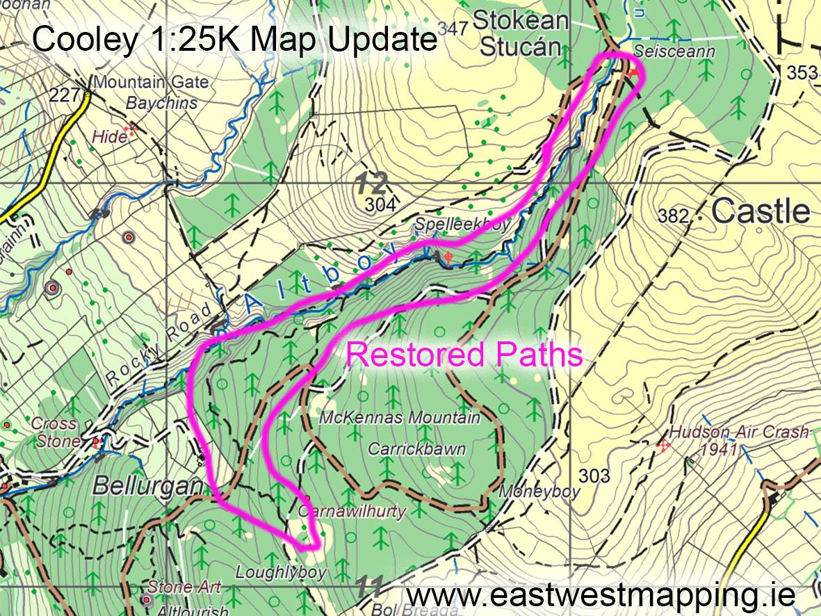
Cooley Map Update ~ Foyles Way
The Cooley region of Louth was badly affected by heavy rain and floods at the end of October, damaging several roads and flooding property. Foyles Way, a popular riverside path with 20+ footbridges was mostly washed away.
Local map user Declan Gray reports now that Joe Foyle and others inc Declan have restored the upper part of the Foyles Way path and created a new linking path. The map extract here shows the parts that are now accessible and the new section.
This extract is from our Cooley 1:25,000 scale map and located not far from the Lumpers Pub.
#eastwestmapping #cooley #carlingfordheritagecentre