Auto Mapping New Zealand
There have been some interesting developments in medium scale ‘computer generated mapping’ in Finland and New Zealand in the last year or so. These have been led by the sport of orienteering which has a requirement for detailed topographic map detail of often complex areas. But which techniques should be extendable to more general topographic mapping.
The key to this solution is the use of LiDAR data – a remote sensing technology that captures fine detail on the surface of the earth. Several countries have ongoing programmes to capture LiDAR datasets for their territory and a number of these are making this data freely available to the public. New Zealand is one of these states with plans for 80%+ coverage within the next 2-3 years.
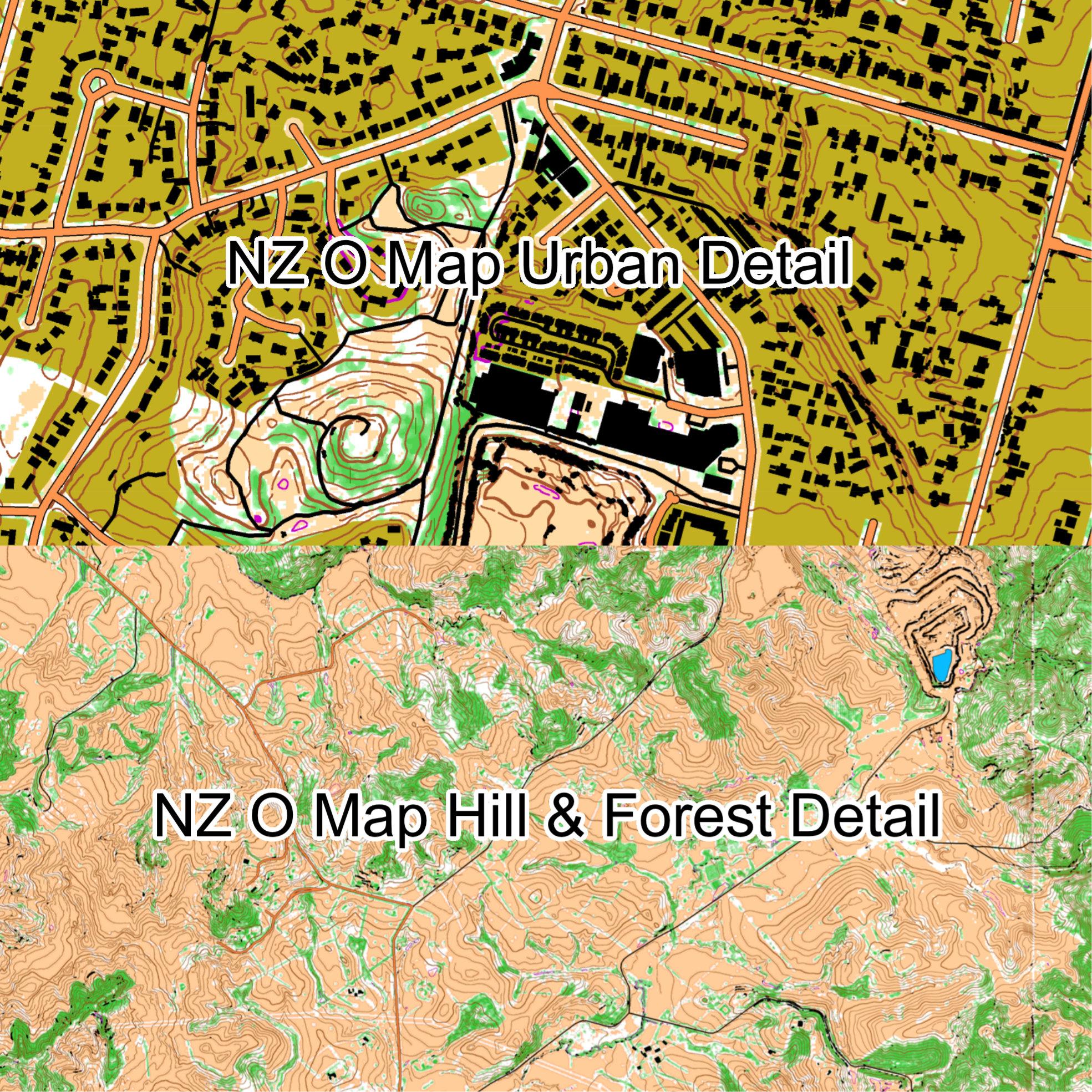
In the example here http://omap.nz/index.html, this NZ LiDAR data is being processed with the software Karttapullautin by Jarkko Ryyppö of Finland. This analyses the detailed LiDAR datasets taking into account ground elevation, vegetation and buildings etc. to generate editable maps. Just like the far simpler Optical Character Recognition (OCR) that turns typescript sheets into editable text, the resulting text or map detail is not perfect. There will be mistakes, omissions and misinterpretations that need correction – but the results are quite impressive and a lot of the basic donkey work of drafting detail can be auto generated. The examples here of both urban and hilly areas have a lot of reasonable quality detail that is tedious to draw manually.
Is this the future of open source topographic mapping in Ireland? Possibly, though this is reliant on LiDAR data being flown here on a countrywide basis and such data being supplied free or at nominal cost to the public. Combined with individuals with sufficient processing power, knowledge & time to turn it into map detail. Such mapping can never be as reliable as that where human interpretation and ground survey is applied but that’s not quite the point. It only has to be ‘good enough’ and ‘usable’ if it’s open source and free.


