Other Map Publishers: OpenStreetMap
Part eight of a series on Irish Mapping: past, present & future.
OpenStreetMap or OSM is a mystery to me. Founded by Steve Coast in the UK in 2004, just 20 years ago, it is styled as ‘citizen mapping’ – the Wikipedia of Cartography. The idea that citizen volunteers will collaborate to survey, collect and publish open source map detail. Which is fine, laudable and achievable at a local level. However you’ll do well to find parts of the world in 2024 that are not mapped in some detail by OSM. Frankly the idea that citizen volunteers have achieved this remarkable task of mapping the world in 20 years is not credible and the reality is that there are large corporations like Microsoft, Apple and a host of others backing OSM with resources and finance.
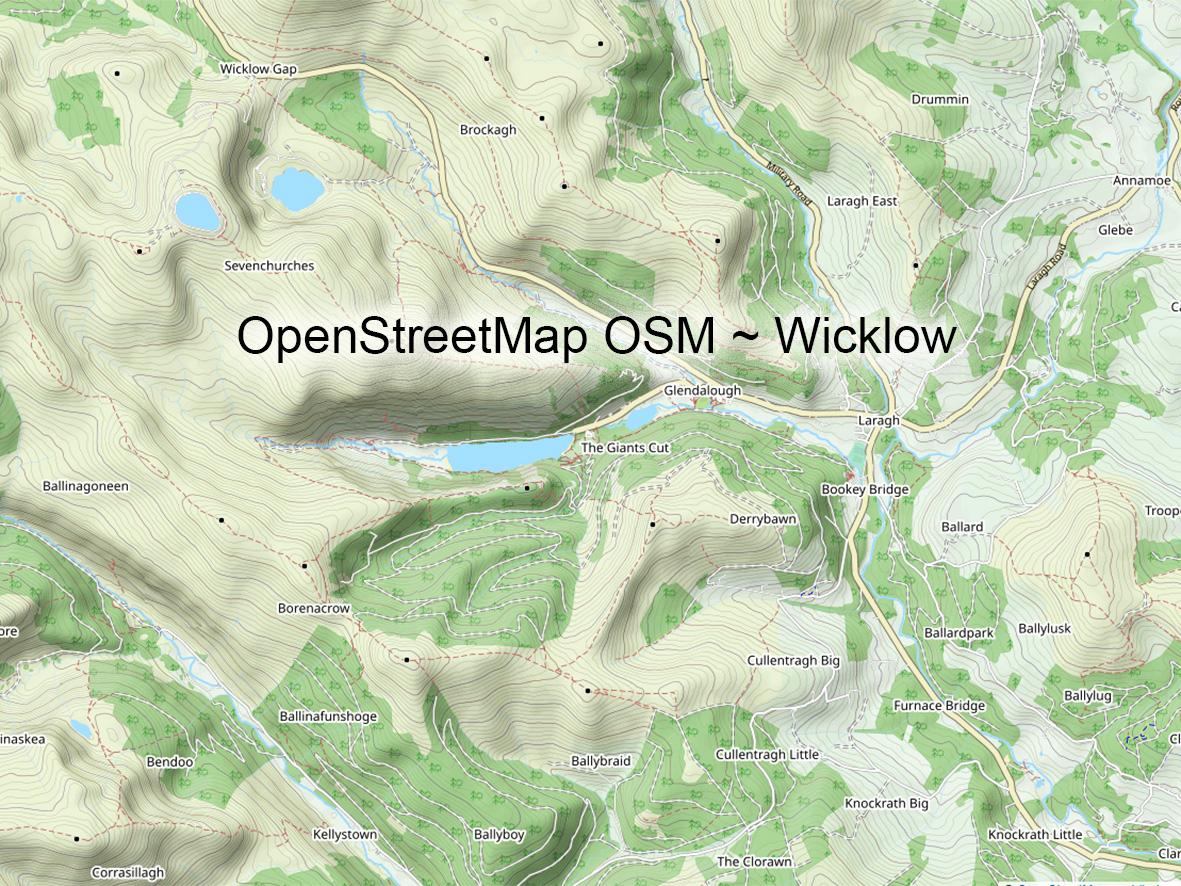
How does this relate to Irish mapping? Well OSM detail is pretty much on a par with and better even than the state Discovery map series in places like Wicklow. Less placenames but with more up to date path and track detail. In lesser used areas it’s patchier and this certainly correlates with the concept of local citizen mapping. Urban areas are well mapped and if a new road/ bypass is built, it pops up very quickly on OSM, suggesting some level of interaction with the local & state bodies. There is a small but active OSM Ireland community, details at openstreetmap.ie
The important thing about OSM is that it’s open source data, free to use for all and so it’s found as a base layer of map detail on virtually all navigation type apps and systems now. It’s also frequently found as a web map online on everything from weather to property sites. OSM currently has c10 million registered users but it’s real reach to ordinary users would be many times this. The big explosion in OSM use happened around 2012 when the restrictions on free commercial use were significantly changed. The quantity and quality of data now in OSM must be hugely valuable, which is why the big corporates are backers. OSM and GoogleMaps are effectively two giants in competition with each other to see who will dominate & control world digital mapping.
#eastwestmapping #openstreetmap #irishmaps #mountainviews #mountaineeringireland


