Last in this short series on weather maps & forecasts. To recap on previous:
Air circulates (wind direction) in anticlockwise way around Low areas of pressure and in a clockwise way around High pressure.
The closer the isobars, the windier and more active any weather system, rain etc.
The overall direction & nature of the prevailing air mass has a large effect.
Weather fronts, changes in air mass, usually mean rain on the hills.
Some other pointers:
Despite the changeable nature of our climate, weather we experience often sets into a repeating pattern than can last for weeks.
Get in habit of looking at weather charts and forecasts every day for a while, even if not heading for the hills. Watch what happens during the day, the timing and how it all turns out relative to what you expected. It’s like map reading & navigation, you need to practice.
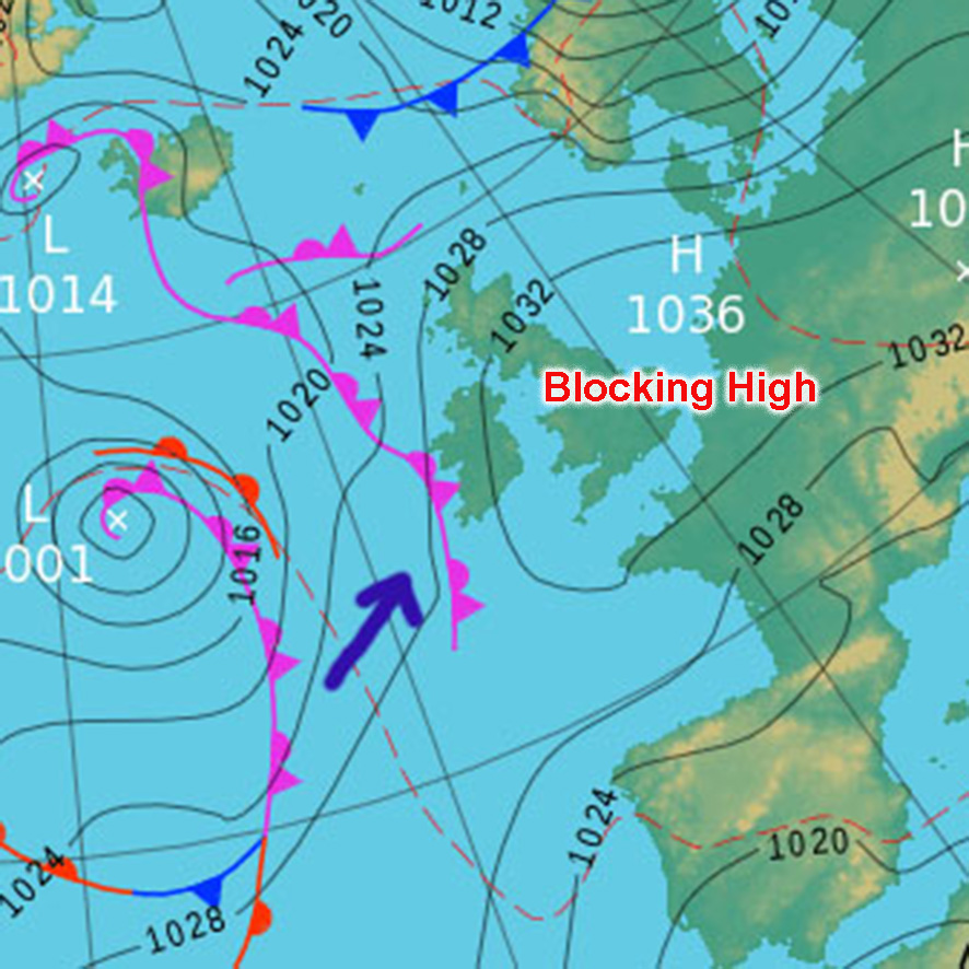
Whilst our weather systems normally come from the Atlantic and cross Ireland quickly, sometimes we have a ‘blocking high’ as illustrated here. When this high is centred over Europe and extends to Ireland, this has the effect of keeping incoming depressions at bay and steering them away from us. This can last for a week and more often. If the blocking high is further east, this allows low pressure and rain to extend over Ireland and can sit over us for much longer than normal.
Snow & ice. Cold, wet air in winter coming from the east, northeast and north in winter will feed in snow from the Irish Sea direction. Also when cold air from east runs up against warm wet air from the west in winter. The warmer, wet air rises over the bitter cold air mass and falls as snow/ blizzard on the hills as the front crosses us.
#eastwestmapping