Ordnance Survey 19th Century
Part two of a short series on Irish Mapping: past, present & future.
The century opened with the Act of Union and a relatively quiet period on the war front for the British Empire. Irish subjects now theoretically had the same rights as those in Somerset. The large body of private surveyors and valuers were busy dealing with estates and each county was commissioning it’s own county map.
However this was all about to change, there was considerable disquiet about the unfair way that taxation was levied on landowners with glaring anomalies between even neighbouring counties. A series of enquiries were held to investigate taxation in Ireland culminating in the Spring Rice Report of 1824. This led to the setting up of two important bodies 1) the boundary survey and townland valuation under Richard Griffith – this to decide what the townlands of Ireland were, to fix their boundaries and value the land and 2) the Ordnance Survey of Ireland to be run by the British military and who’s role was to survey, map and measure Griffiths townlands. This latter task resulted in the Six Inch Survey or 1:10560 scale of the entire island, a mammoth task and was completed by 1846 taking about 15 years.
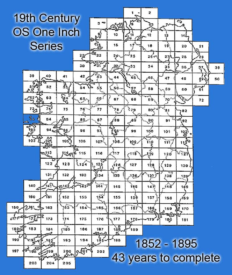
But we are interested here in medium and smaller scale mapping and there was an intention to produce a One Inch series or 1:63,360 scale, similar to the 1:50,000 now. Now the OS had all the basic detail plotted on the Six Inch maps, it simply needed reduction, simplification and some method of showing relief added. This task was started c1852 but not completed till 1895, that’s 43 years. Compare that to 15 years for the original survey fieldwork and you get a very clear idea as to importance attributed to small scale mapping by the Ordnance Survey of Ireland of the 19th century. Smaller scales mapping in Ireland was an afterthought.
The Ordnance Survey had refused to employ Irish land surveyors in the Six Inch survey, and these men increasingly found that their means of a living was taken away as naturally landowners could now purchase government maps without the need of employing surveyors.
#eastwestmapping #cartography #irishmaps