Map Update Queries
I’m currently making a round of updates to our mapping. Have a couple of queries which users may be able to shed light on. These are in relation to two new reported track/ forest road developments. Both in Wicklow. If you’ve seen them, I’d appreciate confirmation. Ideally if you also have a photo and/or a track recording from an app like Hiiker or Strava etc., but any info appreciated.
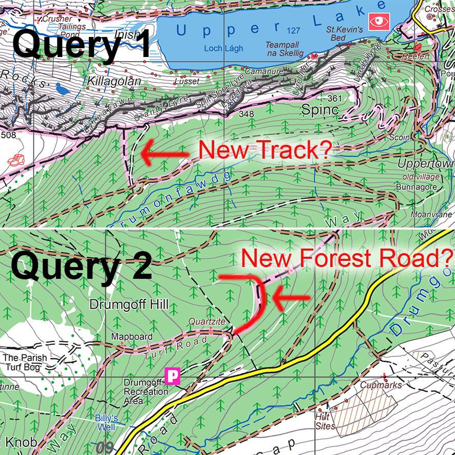
Query 1. A new track leading down southwards off the Spinc ridge. About where the Spinc Short Loop goes down through the wood. I’ve marked what I think maybe it, but not sure of shape.
Query 2. Just above the Drumgoff Recreation car park on the road between Glenmalure and Aughavannagh, the Wicklow Way walking route meets the forest road. Report here that a new forest road has been surfaced around the hill, but where to? Have you seen it? Does it link to other forest road below or just stop?
Thanks if anyone can shed light on these or if out that way in next week or so, keep an eye out 😊
#eastwestmapping #mountaineeringireland