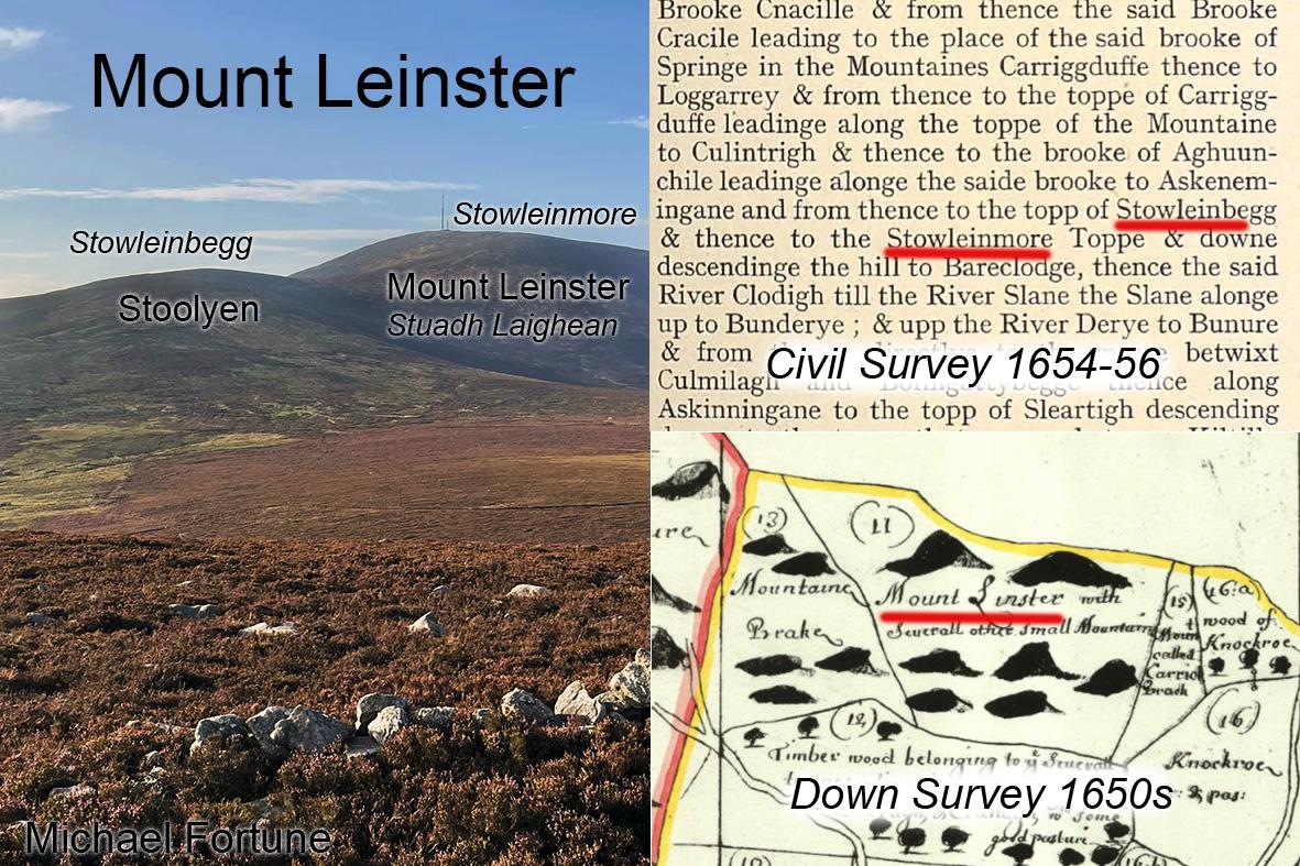
Map & Written Records
Maps that define land divisions are long the norm but these replaced an older tradition of describing territory with a written description of it’s boundaries using landmarks. Both systems existed in parallel in Ireland for a couple of centuries and leave interesting records. Two such sets of documents were made in the 17th century associated with identifying lands that could be confiscated for the purpose of plantations. These were the Down Survey maps made under the direction of William Petty and the contemporaneous Civil Survey made by local inquisition in the years 1654-56.
Here we have examples of both relating to Mount Leinster on the border of Carlow & Wexford, the southern spur of which is still known as Stoolyen. The Down Survey Map shows the name Mount Linster, the earliest known version of Mount Leinster, which an old text refers to as Stuadh Laighean, the peak of Laighean – a group of people. The written Civil Survey for Wexford describing the boundary of the Baronry of Scarawalsh, though gives different names. What we now know as Stoolyen is called Stowleinbegg whilst Mount Leinster is referred to as Stowleinmore – the little Stowlein and the big Stowlein.
Stowlein itself is a version of Stoolyen and Stuadh Laighean. It seems that the ‘Anglo Norman’ settlers took the name Stowlein and reversed it. What was Stuadh Laighean or Stowlein became Lein-stow, Leinster.
Other names in this written boundary description are Carriggduffe – Blackstairs, Loggarrey – the hollow on Blackstair, Bunderye – the foot of the Derry river & Sleartigh – what must have been a name for what is now called Gibbet Hill.
#eastwestmapping #irishhistory #blackstairs