Future of Irish Mapping ~ EastWest Mapping
Final part of a series on Irish Mapping: past, present & future.
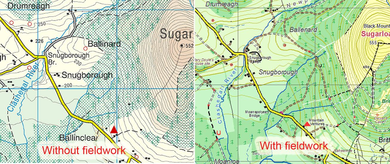
EastWest Mapping has been on the go for 30+ years, of which the last 15+ have been devoted to developing and publishing better maps for the Irish public. We have 20 sheets now covering some 10,000+ sq kms. A tremendous amount of time & research has gone into these but the reality is that only about a third of these sheets would pay back the costs of developing them.
I could point to many factors that complicate & mitigate against such map publishing but at the end of the day, the biggest single factor is proximity to or distance from centres of population which mainly lie to the east. The complete lack of state support, the grossly inequitable VAT situation and the growing adoption of free online mapping also contribute.
I’m currently working on a new version of our Blackstairs & Mount Leinster, published 2013 to bring it to the same standard as our mapping of recent years. This will be printed later in the summer and ready for the autumn hopefully.
After this, we’ll be taking a pause to reassess. I’ve been happy to use my talents, interest, time & money to make better maps for the public but there’s a limit to how much investment we can justify. Our existing mapping will be updated & kept in print, given sufficient demand.
This is not to say that EastWest Mapping will never produce another map. We get many requests for better maps of Donegal for example. But experience is that after the first few hundred are purchased by regular users, sales drop substantially. One route would be via a crowd funding model, would sufficient people/ bodies put their money up? I’ve avoided it to date as instinctively don’t like taking money for complex projects well in advance of delivery. But it may be the only practical way.
#eastwestmapping #irishmaps #mountainviews #mountaineeringireland