


Wild Nephin Folded
€11.00
Description
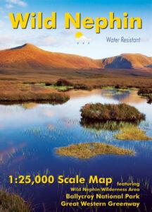
Definitive detailed map of the Nephin Beg mountain region.
Covers Ballycroy National Park, Wild Nephin Wilderness Area, Bangor Trail and parts of the Great Western Greenway and Western Way. Depicts the terrain in very considerable detail for the benefit of anyone exploring this remote region. We have conducted considerable research into local placenames and many names are located & recorded here for the first time. Printed on good quality Enduro 100 gsm paper. Water resistant and tear resistant, read care instructions in FAQ. 1:25,000 Scale : 1 centimetre on the map = 250 metres on the ground. Contour Interval : 10 metres.
Covers from Newport to Mulranny and Bangor Erris to Bellacorick. Published August 2015.
Additional information
| Weight | 0.1 kg |
|---|---|
| Dimensions | 12 × 1 × 17 cm |