Dublin Mountains Paper
Dublin Mountains 1:25,000 Scale Map
Continue Reading
Dublin Mountains Paper


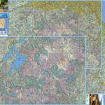
Our three new 1:25000 scale maps for the northern Dublin & Wicklow mountains have gone to proofing stage with the printer. These are prepared to our 25Series standard with 5…
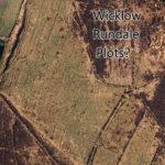
Rundale was a system of land management between farmers that seems to have common enough in the west of Ireland in early/ mid 19th century. It predated the enclosure of…
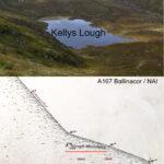
I have reported here previously that the hill overlooking Kellys Lough in Co.Wicklow is locally called the Lough Mountain. This is erroneously labelled as Corrigasleggaun on some maps. This name…

About a week ago, Bernadette Danaher posted photos taken by her brother from the South Stack lighthouse, near Holyhead in Wales. The photos were taken at dusk with the sun…
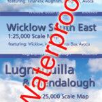
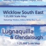
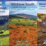
Lugnaquilla & Glendalough Wicklow South Wicklow South East Three definitive detailed maps of the southern Wicklow hills and county in our new 25Series for Wicklow. Surveyed 2017-2018, depicting in detail…
Lugnaquilla & Glendalough Wicklow South Wicklow South East Three definitive detailed maps of the southern Wicklow hills and county in our new 25Series for Wicklow. Surveyed 2017-2018, depicting in detail…
Lugnaquilla & Glendalough Wicklow South Wicklow South East Three definitive detailed maps of the southern Wicklow hills and county in our new 25Series for Wicklow. Surveyed 2017-2018, depicting in detail…