Glenasmole
Glenasmole To conclude this mini series on the lovely valley of Glenasmole, let us consider the name and it’s possible meaning. There are two lines of thought: the first is…
Continue Reading
Glenasmole


Glenasmole To conclude this mini series on the lovely valley of Glenasmole, let us consider the name and it’s possible meaning. There are two lines of thought: the first is…
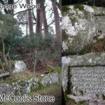
Finn McCool’s Stone The Castlekelly bog road starts at the back of Glenasmole valley and a short way in on the left is a large granite rock called Finn McCool’s…
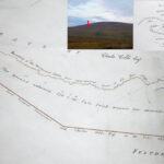
The New Mearing I’m sure a good few readers here have approached Kippure Mountain in the Dublin Hills by means of the long straight Moat Bog Road from the Featherbeds.…
Many people who drive along the Military Road across the Featherbed Bog in the Dublin Mountains would be unaware of this simple but remarkable stone. It's only a couple of…
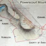
Kippure Estate UpdateTim & Della Kyne developed Kippure House into an adventure/ event/ conference centre back in the early 2000s. Called Kippure Estate it offered school tours, corporate days out,…
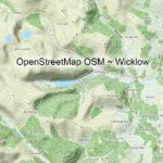
Other Map Publishers: OpenStreetMapPart eight of a series on Irish Mapping: past, present & future.OpenStreetMap or OSM is a mystery to me. Founded by Steve Coast in the UK in…

Other Map Publishers: HarveyPart five of a short series on Irish Mapping: past, present & future.As far as small & medium scale mapping in Ireland goes, two map publishers have…
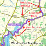
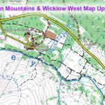
Sugarloaf Way Update Map update for our Wicklow East 1:25,000 print map. The Wicklow Way is a popular signposted walking trail and there have been moves afoot for many years…