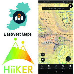
EastWest Maps Customers to Hiiker
Important changes to EastWest Maps phone app. EastWest Mapping digital maps running on phone app EastWest Maps are migrating to a new Hiiker phone app. Currently digital maps by Eastwest…

EastWest Mapping Blog
Important changes to EastWest Maps phone app. EastWest Mapping digital maps running on phone app EastWest Maps are migrating to a new Hiiker phone app. Currently digital maps by Eastwest…
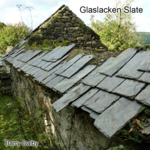
The rural countryside is full of local interest, there are often little things to be spotted if you take the time to stop & ponder. The photo here was taken…

On the summit of Knockmealdown is said to be buried Henry Eeles (1702-81), his dog and his gun. The position of the grave of Major Eeeles or Eccles is marked…
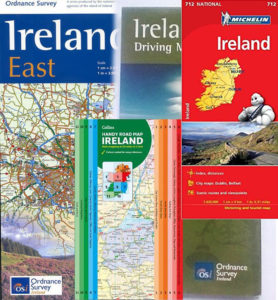
I was an agent for Ordnance Survey Ireland tourism & leisure maps in the early 2000s. The biggest sellers were Ireland road maps of which OSi had several flavours, plus…
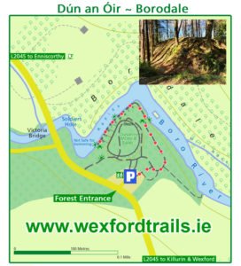
If you’re travelling to the Rosslare ferry this summer in Wexford and have time for a wee detour, it’s well worth taking a break at the small forest recreation area…

Our new detailed maps for The Reeks and Killarney are available online from EastWest Mapping. But for those who’d like to pick up a copy locally, here is a list…
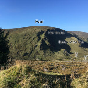
The Fair is a rounded hill just west of the Turlough Hill ESB pumped storage scheme in Wicklow. The photo here shows two of the large pylons that run down…
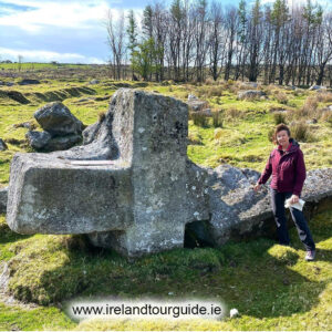
Dairine Nuttall of www.irelandtourguide.ie posted this fine photo of the Ballintubber Cross recently. This lies on the eastern slopes of Blakestown Hill and looks down on Poulaphuca Reservoir. It’s marked…

If you’re participating in the Knockmealdown Crossing this coming weekend, you just about have time to order our detailed 1:25K map of the Knockmealdowns, the best map of the area:…

Making slow progress on our Dingle mapping project but will get there in the end. Plan is to compile our 25Series map detail for the full peninsula from the Blaskets…