Blackstairs & Mount Leinster Map Update
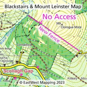
Blackstairs & Mount Leinster Map Update Thanks to map user Pat Lambert, who has reported that a new substantial deer type fence is being erected along the forest SW of…

EastWest Mapping Blog
Blackstairs & Mount Leinster Map Update Thanks to map user Pat Lambert, who has reported that a new substantial deer type fence is being erected along the forest SW of…
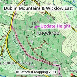
Knockree Update Thanks to map user Chris Crocker who has pointed out an error at Knockree on our Dublin Mountains and Wicklow East print maps and current digital map. Chris…
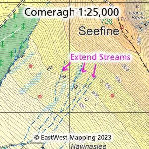
Comeragh Map Update Thanks to map user John Hughes, who reports on the various streams on the SW flank of Seefine in the Comeraghs. That these run higher on the…
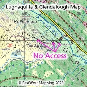
Lugnaquilla & Glendalough Map Update The Zig Zags. Following the recent despicable assault in Glenmalure, Co.Wicklow – please disregard the agreed access route symbol currently marked on our Lugnaquilla &…
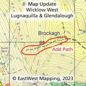
Brockagh Map Update If you have a copy of our Wicklow West and/or Lugnaquilla & Glendalough map, you might like to note the following map update. Thanks to map user…
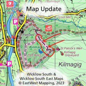
Avoca Map Update If you have a copy of our Wicklow South and/or Wicklow South East map, you might like to note the following map update. It concerns the lovely…
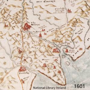
Cooley 1601 An early & interesting map of Cooley & Mourne districts. Dated 1601, there are numerous hills marked on the lands south of Newrye. If anything, the Cooley peninsula…
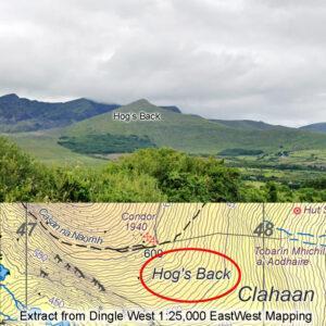
Hog's Back There’s a typo on our recently published Dingle maps, I spotted it after printing and it’ll be updated. If you walk the popular Faha pilgrim route up Mount…
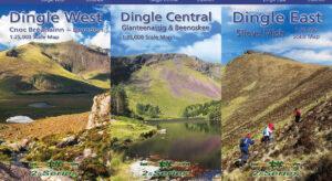
New Dingle Maps Three new detailed 1:25,000 scale maps for the Dingle peninsula are now available. Please share this news to anyone who you think will be interested and find…
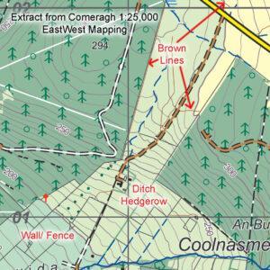
Brown Lines What are the ‘brown lines’ on maps by EastWest Mapping? We use three line symbols for boundaries/ linear features on our maps ~ in green, black & brown.…