Cruach na Tuile
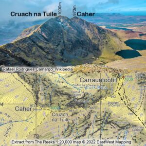
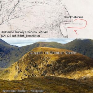
No map was ever published that didn’t need corrections. Usually I make annual updates to our digital maps but this particular correction warrants more immediate attention as it concerns a…

No map was ever published that didn’t need corrections. Usually I make annual updates to our digital maps but this particular correction warrants more immediate attention as it concerns a…

Spring is coming in, the mountains and glens are calling and I wish to advise that our two new maps for The Reeks and Killarney National Park are now available.…
Our new Reeks map will be available later this week. As with our other map productions, I’ve made as thorough an investigation into placenames as practical. There is no doubt…
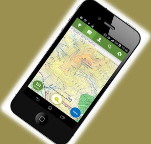
A few people have enquired recently as regards the future use of EastWest Mapping maps on the phone app ViewRanger which is to close. Please note that we had a…
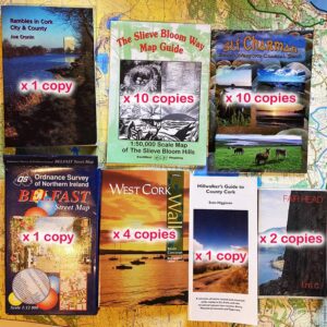
Before we started publishing more of our own maps, I used to sell other publishers guidebooks and maps. Sorting through boxes here and find I have the following copies of…

Being someone who compiles and publishes maps, I’d have an interest in many associated aspects including geography & history. Our son gave me a copy of ‘The Power of Geography’…
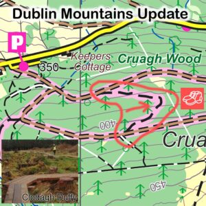
If you have a copy of our Dublin Mountains map, then you should take note of this small update to the ever popular Cruagh Wood. This is one of a…
You don’t associate glaciation much with Mount Leinster & Blackstairs, they were likely covered or nearly so by the ice sheets of the past. However there is one small example…
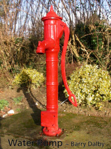
The communal water pump is a feature still to be seen in rural villages around the country. Recent years have seen an interest in restoring these old cast iron pumps…

The centenary of the Treaty that led to the foundation of the Irish Free State is in the news currently. This treaty agreed in London was subsequently debated and voted…